
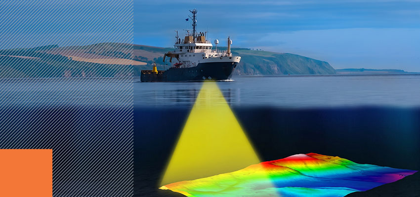
For survey supervisors and procurement specialists, sonar selection is a decision with project-wide consequences. Survey conditions and project requirements, not technological advancement alone, determine the right choice for your needs.
Single-beam sonar operates along a single track line and sends one ping at a time, measuring depth at one position. Multibeam sonar, by contrast, captures a full swath of seafloor in each pass. The framework below explains how each system operates and helps match multibeam vs. single-beam sonar technology to project conditions.
Single Beam Sonar’s Strengths, Limitations, and When It Still Makes Sense
Single-beam sonar remains a practical and cost-effective tool for many marine surveys, provided it fits within their defined limits.
The One-Beam, One-Echo Principle
A single-beam echo sounder (SBES) operates through direct downward transmission. One transducer emits an acoustic pulse, measures the return echo travel time, and calculates depth using the sound velocity. With beam widths ranging from 3°-24°, the systems deliver depth measurements from 0.15 meters to 200 meters, depending on model specifications.
Each ping produces one data point at one geographic position. Frequency ranges are available in single- or dual-configuration options to address varying bottom conditions, and these beams can be deployed by a single operator.
Where Single Beam Sonar Delivers
Single-beam sonar performs most efficiently under specific survey conditions:
- Shallow water surveys of 5-10 meters in depth
- Simple cross-section profiles and channel maintenance checks
- Rapid single-operator deployments in confined spaces
- Budget-constrained projects where full seafloor coverage falls outside project requirements
- Routine maintenance condition assessments in active shipping channels
Coverage and Data Limitations
Capturing seafloor features across an area with a single-beam sonar requires multiple passes with closely spaced survey lines. Gaps between adjacent track lines can conceal seabed features that affect navigation or construction planning. Compared to multibeam systems, SBES data density averages 0.69 points per square meter versus 7.71 for multibeam coverage, although this varies by system, spacing, and mode.
Single-beam surveys deliver adequate data for routine channel maintenance checks. Meeting some International Hydrographic Organization (IHO) S-44 Order 1a or Special Order compliance standards requires full seafloor search and object detection capability, which may require multibeam coverage.
How Multibeam Sonar Works
Multibeam sonar closes the gap left by single-beam sonar by capturing hundreds of soundings in a single pass. Its engineered design, real-time mapping, speed, and data density give it the advantage.
Fan-Shaped Arrays and Simultaneous Beam Formation
Multibeam systems emit hundreds of acoustic beams in a fan-shaped pattern perpendicular to the vessel heading. Using beam-forming technology, the systems extract directional information from returning acoustic waves across up to 180° of angular coverage, depending on system configuration.
Across the full swath width, vessel motion directly affects beam positioning. A one-degree roll shifts sonar beam positions across the entire coverage area. Reliable multibeam output depends on integrated inertial navigation systems that compensate for roll, pitch, and heave in real time.
Real-Time Three-Dimensional (3D) Bathymetric Mapping
Receiving hundreds of return echoes per ping, multibeam systems generate dense point clouds that produce real-time 3D seafloor models. Beyond depth measurement, backscatter data capture the intensity of returning acoustic energy, revealing seabed classification information such as sediment type and bottom hardness. This level of data provides resolution sufficient for feature detection and compliance documentation.
Coverage Speed and Data Density Advantages
Thanks to their fanned design, multibeam echo sounders (MBES) capture significantly more data per pass than single-beam systems. The volume of data being collected allows wide areas to be mapped much faster, with more usable data at the end of the day.
What Multibeam Requires
Multibeam deployment demands more than sonar hardware alone:
- Initial equipment investment: Multibeams are more expensive than single-beam systems.
- Integration requirements: Satellite positioning, inertial navigation, sound-velocity profiling, and system calibration must function as integrated components.
- Data processing demands: Dense point cloud processing requires purpose-built software and trained operators.
- Crew training: Operating and maintaining multibeam systems requires technical knowledge beyond basic MBES operation.
For large-area surveys, compliance-driven projects, or work requiring three-dimensional surface models, the investment returns through reduced vessel time and faster data delivery.
Choosing the Right Sonar Technology for Your Project
Survey conditions and compliance requirements determine which sonar technology fits a specific project. Consider the following factors.
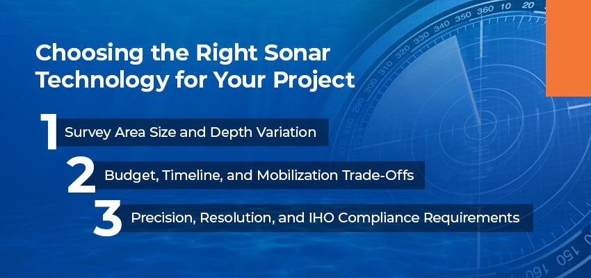
Survey Area Size and Depth Variation
Survey area size and depth variability point toward the appropriate technology. Large survey areas, variable bottom topography, and deeper water favor multibeam systems. When the survey area is compact or shallow, single-beam deployment works well. Bottom complexity and feature-detection requirements carry equal weight with area dimensions.
Budget, Timeline, and Mobilization Trade-Offs
Consider the total cost over time. On large survey areas, multibeam efficiency reduces vessel time, fuel consumption, and crew hours. Higher equipment investment can produce lower total survey costs through operational efficiency.
For small projects, single-beam systems offer lower costs and faster setup. Multibeam systems produce complete 3D surfaces faster, reducing turnaround time for permit applications and dredge planning.
Precision, Resolution, and IHO Compliance Requirements
Project specifications and regulatory frameworks determine technology requirements before mobilization begins. Permit requirements from U.S. Army Corps of Engineers (USACE), IHO standards, and project-specific specifications should inform the technology decision during planning.
Multibeam Sonar Applications in Dredging and Environmental Surveys
Multibeam sonar dredging and environmental compliance work deliver capabilities that single-beam sonar does not.
Multibeam Sonar for Pre-Dredge Planning and Volume Calculations
During dredging feasibility studies, multibeam surveys generate higher-fidelity pre-dredge bottom models. From dense bathymetric mapping sonar data, project managers can calculate material volumes and identify seabed conditions, including cave-ins, soft spots, and submerged debris that affect dredging approach and equipment selection.
Inaccurate volume calculations affect bid pricing, permit documentation, and production planning across the project timeline. Mounting multibeam systems directly on dredge equipment and integrating the sensors with purpose-built marine construction software enables real-time bottom updates as operations progress.
Maintenance Channel Surveys
Periodic bathymetric surveys in federal navigation channels document channel depth conditions and sediment accumulation rates. Survey data informs dredging trigger points and permit compliance documentation for ongoing maintenance programs.
For routine maintenance checks in active shipping channels, single-beam condition surveys provide adequate data. New-work surveys and compliance documentation may require multibeam coverage.
High-Precision Environmental Mapping
Environmental permits for dredging operations require pre- and post-activity surveys demonstrating limited habitat impact. From backscatter data collected during the same survey pass that captures depth measurements, multibeam systems classify seabed sediment and substrate types.
Under the Marine Protection, Research, and Sanctuaries Act, the Environmental Protection Agency (EPA) requires testing and evaluation of all dredged material proposed for ocean disposal. Accurate bathymetric data before and after dredging operations supports compliance documentation.
Emerging Survey Technology and the Case for System Integration
Sonar technology continues evolving. The case for treating survey equipment as a single integrated system is also gaining traction.
Scanning Sonar and What Comes Next
In confined spaces, around structures, and in areas where fixed-mount systems cannot achieve full coverage, scanning sonar complements single-beam and multibeam capabilities. Unmanned surface vehicles now carry survey sensors into environments where crewed vessels face operational constraints.
Research from the Nippon Foundation-GEBCO Seabed 2030 Project shows we’ve mapped less than 30% of the global ocean floor — although U.S. waters are leading the way at 56% mapped. National Strategy for Mapping, Exploring, and Characterizing the U.S. Exclusive Economic Zone (NOMEC) sets targets calling for accelerated progress, and advanced sonar technology will be a key factor in the NOMEC implementation plan.
System Integration, Software Compatibility, and Data Workflow
Beyond the sonar transducer alone, reliable bathymetric data depends on how the complete system works together. GNSS positioning, inertial navigation for motion compensation, calibration procedures, purpose-built processing software, and trained crew members each contribute to final data quality.
Purpose-built integration of survey components reduces processing time, minimizes data errors, and supports compliance documentation requirements across the project workflow.

Partner With Measutronics for High-Precision Sonar Solutions
Beyond selecting the right sonar technology, reliable survey data depends on complete system integration. GNSS positioning and inertial navigation work alongside sonar to maintain sounding precision under real marine conditions.
From equipment specification through installation, calibration, and crew training, Measutronics designs and integrates marine survey systems that deliver dependable results. Learn more about our solutions today.