


Robotic Total Stations
Marine robotic total stations (RTS) from Trimble utilize advanced robotics and optics to simultaneously measure angles and distances synchronized for ultimate real-time tracking accuracy. We offer models specifically designed for the dynamic conditions found in marine environments.
Unlike many RTS instruments, ours perform true synchronized angle-and-distance measurements (same epoch), producing a single coherent 3D position at one time stamp that minimizes motion-induced errors on moving vessels and structures. Features like high position update rates and low latency allow for real-time monitoring and responsive adjustments even as conditions change.

GNSS & RTK Receivers
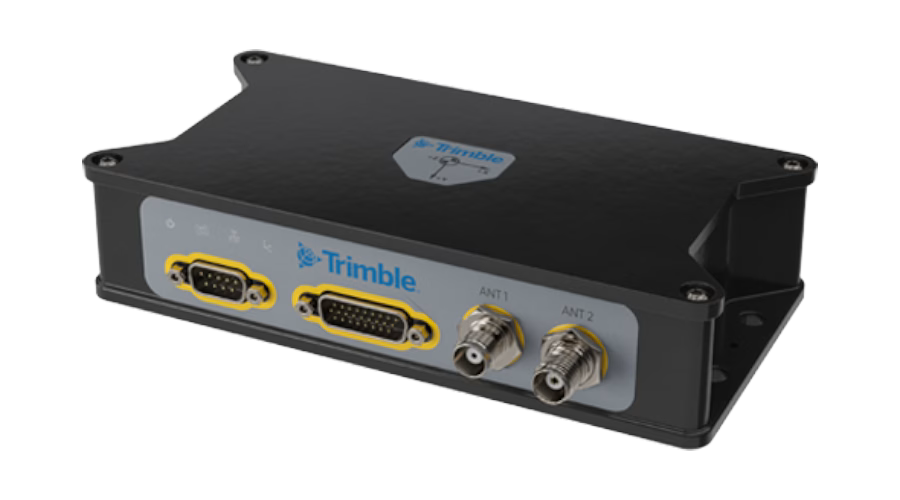
Our marine GNSS receivers and antennas are advanced satellite navigation systems that receive signals from multiple satellite constellations to deliver survey-grade positioning. Receivers from top brands like Trimble and Applanix provide precision position and orientation data for vessels and heavy machinery afloat, making them suitable for a wide range of hydrographic, bathymetric, marine construction, and dredging applications — from basic DGPS to precise RTK positioning.
Software & Controllers
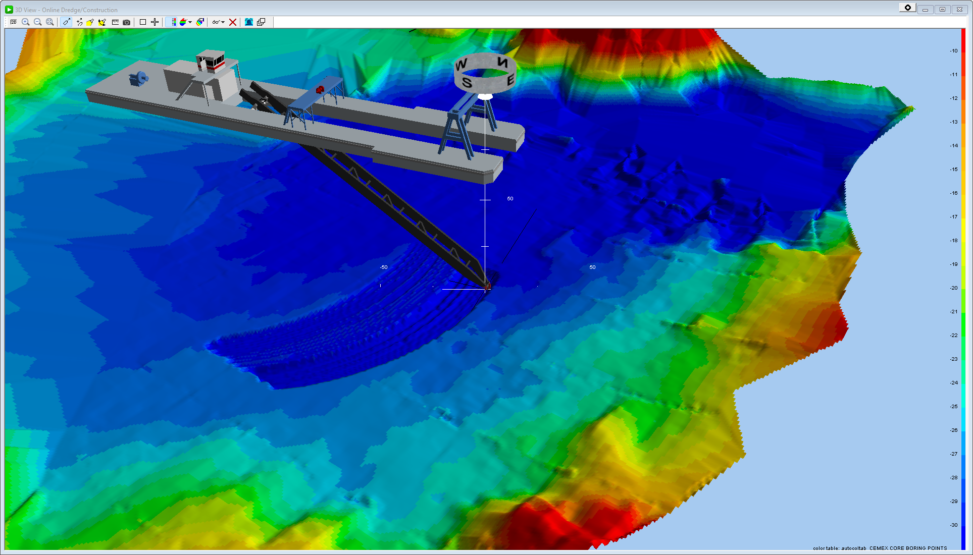
Measutronics offers marine construction and hydrographic survey software for data preparation, real-time machine guidance, precise georeferencing, and fleet monitoring. Its solutions—including Trimble Business Center, Trimble Marine Construction, Applanix POSPac, and ConnectedDredge—work together to support a connected workflow from planning through reporting.
Marine Antennas & Accessories
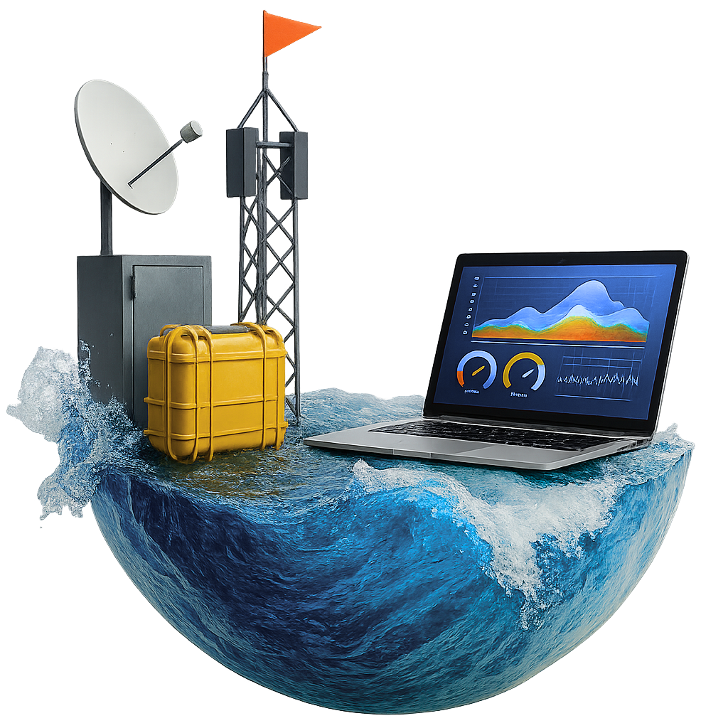
Measutronics offers marine-grade GNSS antennas, wireless communication antennas, mounts, cables, and related accessories designed for reliable positioning and data transmission in harsh marine environments. Their experts help integrate compatible solutions with Trimble, HYPACK, and third-party systems for applications such as hydrographic surveying, dredging, and marine construction.
Inertial Navigation Systems
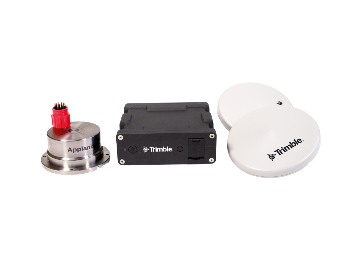
Enjoy a robust, user-friendly system that delivers comprehensive positioning, including heading, attitude, heave, and velocity data for your marine vessel and remote sensing equipment. Our Applanix systems are field-tested to work in even the most challenging conditions. By blending GNSS data with inertial motion unit (IMU) measurements and heading information, our inertial navigation systems deliver a complete six degrees-of-freedom solution — for precise navigation and monitoring even when GNSS signals are limited.
Hydrographic Echo Sounder
Measutronics supplies CEE HydroSystems single-beam echo sounders for accurate, reliable hydrographic depth measurement in applications such as dredging, bathymetric charting, and underwater infrastructure inspection. Its CEE-LINE™, CEESCOPE™, and CEE ECHO™ systems offer varying configurations, depth ranges, and integration options, backed by turnkey installation, training, demos, and technical support.
Marine Positioning and Guidance Systems
Ensuring Your Success with Positioning and Guidance Solutions from Measutronics
Technology adoption in maritime operations is accelerating at a rapid pace — especially in real-time positioning and integrated guidance systems. Advanced marine guidance equipment is designed to overcome challenges like real-time positioning accuracy, data reliability, and operational awareness.
Unlock new levels of precision and efficiency in your marine construction and dredging projects with Measutronics on your team.
Our industry-leading application of technology delivers reliable situational awareness even in the most challenging environments, enabling operators to make informed decisions and maintain precise control during marine construction and dredging projects. Let our experienced team work with you, integrating various technologies into a complete marine guidance system that dovetails with your workflows and addresses your unique challenges.
Explore Our Marine Positioning and Guidance Solutions
Measutronics offers a full suite of technologies that integrate seamlessly with marine guidance systems to deliver superior safety and operational efficiency for projects of every size and scope. We partner with industry-leading manufacturers like Trimble, NORBIT, Applanix, and CEE Hydrosystems connecting our customers with the highest-quality marine products and systems.
We bring decades of experience and diverse understanding in geomatics, surveying, underwater imaging, telematics, construction, and other fields. With every product purchased, we offer a comprehensive customer experience that includes system design, installation, training, and support.
Explore our unique advanced positioning and guidance solutions designed to deliver superior project outcomes.
Partners
We sell and support equipment from industry leading manufacturers like Trimble, Applanix, HYPACK, Carlson, CEE HydroSystems, Valeport, FreeWave, and more.
Trimble
No matter how complex your project, Trimble has marine construction hardware, software and positioning sensors to help you meet and exceed them.
CEE HydroSystems
CEE HydroSystems manufacture hydrographic survey equipment including single beam echo sounders with GPS / GNSS for precise bottom mapping in shallow water environments. The company focuses on providing compact and portable systems that simplify the survey process by combining multiple components into a single waterproof and robust enclosure. Previous product lines include the CEEDUCER™ and CEEDUCER PRO™ “all in one” GPS and echo sounder systems.
Applanix
Applanix Marine products and solutions provide robust, reliable, and repeatable positioning and motion compensation solutions to address the dynamic motions of marine vessels across a number of applications. Marine based mobile mapping and positioning not only cuts costs associated with marine surveys, it also delivers tremendous accuracy.
HYPACK
HYPACK® provides all of the tools necessary to complete your hydrographic, side scan and magnetometer survey requirements. With over 4,000 users around the world, HYPACK® provides you with the software necessary to meet almost any hydrographic survey requirement. It provides the means to design your survey, collect your data, apply corrections to soundings, remove outliers, plot field sheets, export data to CAD, compute volume quantities, generate contours, create side scan mosaics and create/modify electronic charts.
Verizon Wireless
Telecommunications company offering cell phones, wireless plans, accessories & more. We offer managed plans to fit your data transfer and remote access needs
Trimble
No matter how complex your project, Trimble has marine construction hardware, software and positioning sensors to help you meet and exceed them.
CEE HydroSystems
CEE HydroSystems manufacture hydrographic survey equipment including single beam echo sounders with GPS / GNSS for precise bottom mapping in shallow water environments. The company focuses on providing compact and portable systems that simplify the survey process by combining multiple components into a single waterproof and robust enclosure. Previous product lines include the CEEDUCER™ and CEEDUCER PRO™ “all in one” GPS and echo sounder systems.
Applanix
Applanix Marine products and solutions provide robust, reliable, and repeatable positioning and motion compensation solutions to address the dynamic motions of marine vessels across a number of applications. Marine based mobile mapping and positioning not only cuts costs associated with marine surveys, it also delivers tremendous accuracy.
HYPACK
HYPACK® provides all of the tools necessary to complete your hydrographic, side scan and magnetometer survey requirements. With over 4,000 users around the world, HYPACK® provides you with the software necessary to meet almost any hydrographic survey requirement. It provides the means to design your survey, collect your data, apply corrections to soundings, remove outliers, plot field sheets, export data to CAD, compute volume quantities, generate contours, create side scan mosaics and create/modify electronic charts.
Verizon Wireless
Telecommunications company offering cell phones, wireless plans, accessories & more. We offer managed plans to fit your data transfer and remote access needs
Partnering Brands and Technologies
At Measutronics, we’re committed to ensuring our clients receive the most reliable and innovative solutions available. That’s why we partner with industry-leading brands and technology providers known for the highest quality positioning and guidance components.
Learn more about these trusted names in marine positioning, guidance, and underwater imaging:
- Trimble Marine: From advanced positioning sensors to construction hardware, Trimble provides industry-leading solutions for the most challenging environments.
- Applanix Marine: Marine vessels working in dynamic environments rely on reliable and repeatable positioning solutions from Applanix for highly precise orientation data.
- NORBIT: High-performance sonar systems from NORBIT combine advanced acoustic technology with precise positioning capabilities.
- CEE HydroSystems: These compact, user-friendly single-beam sonar systems offer a cost-effective, portable solution for hydrographic and bathymetric surveying. These small, rugged systems are directly compatible with our Trimble RTK data collectors.
Learn More About Our Marine Orientation Systems
The experts at Measutronics are available to help you find the right positioning, guidance, or underwater imaging solution for your specific application. Contact us to discuss your marine project and technology needs.