The Applanix POS MV
When projects demand the very best, experienced marine professionals specify the Applanix Position and Orientation System for Marine Vessels (POS MV). Trusted worldwide, the Applanix POS MV system has set the industry standard for robust, high-precision motion compensation and navigation afloat. Unique among navigation solutions, POS MV is engineered with features designed expressly for challenging marine environments. Applanix POS MV is a user-friendly, turnkey system designed and built to provide accurate position, heading, attitude, heave, and velocity data of your marine vessel and remote sensing equipment. POS MV is field-tested and proven in all conditions. POS MV blends GNSS data with angular rate and acceleration data from an IMU, and heading from GPS Azimuth Measurement System (GAMS) to produce a robust and accurate full six degrees-of-freedom position and orientation solution.

Unlike magnetic compasses, which are vulnerable to interference from steel hulls or nearby equipment, the POS MV’s GNSS Azimuth Measurement System (GAMS) uses dual antennas spaced precisely apart to calculate a reliable, drift-free heading. This innovation ensures superior reliability, even in the presence of electromagnetic interference, a common problem in ports and around construction barges.
Applanix also leverages TrueHeave™ technology to compensate for vessel heave. This technology goes beyond old-fashioned filtering to deliver heave corrections in real time, with no need for trial-and-error filter tuning. The result allows operators to save countless hours on post-processing, delivering clean, artifact-free bathymetry and backscatter data.
Inertial Navigation Systems
Precision is an absolute necessity in marine construction and hydrographic surveying. Dredging operations, pile driving, offshore installations, and detailed seabed mapping all depend on positional and orientational precision under changing conditions. The marine environment can prove to be extremely dynamic. Vessels pitch and roll, ambient conditions shift, and global navigation satellite system (GNSS) performance can degrade near bridges, offshore structures, or other signal-blocking obstacles. In this difficult environment, standard navigation tools reach their limits, and only a specialized inertial navigation system (INS) with GNSS can deliver the necessary position and orientation data integrity.
Addressing the Motion Problem in Marine Construction and Hydrography
Traditional GNSS is designed to provide real-time position coordinates. However, there’s a critical gap. GNSS alone cannot detect a vessel’s orientation in space. A survey vessel that rolls just one degree to port alters the position of sonar beams dramatically. This seemingly small error can translate to significant misplacement of depth soundings across a multibeam sonar’s swath, creating unreliable bathymetry, introducing erroneous data artifacts, and ultimately risking the integrity of construction decisions.
The marine environment further complicates matters. Rolling seas, variable currents, and vessel maneuvers constantly introduce motion that GNSS cannot address. In complex settings, such as working beneath bridges or beside oil rigs, crews may lose GNSS signals entirely, leaving critical data gaps that put both safety and schedule at risk.
The Inertial Navigation System (INS) Solution
To address these evolving challenges and environments, INS steps in as the trusted enabler of marine positioning. By continuously measuring both position and orientation, an INS seamlessly fills the voids that GNSS outages can create and accounts for even high-frequency vessel motions.
In augmenting GNSS systems, an INS uses advanced sensors to calculate a vessel’s position and its exact motion in all six degrees of freedom, even when satellites are out of sight. This means you can rely on uninterrupted streams of position and orientation data during every phase of a marine project, supporting compliant hydrography and robust, risk-mitigated construction.
As a leader in marine technology integration, Measutronics specializes in delivering tailored INS solutions to dredging companies, pile-driving contractors, and hydrographic survey crews. Our solutions deliver precision where it matters most, increasing safety and operational efficiency.
How Marine Inertial Navigation Works
Marine operations demand reliable data, even as conditions shift. Understanding the mechanisms behind inertial navigation clarifies how surveyors achieve improved precision, enabling confident decisions in complex and changing underwater environments.
Tight Coupling
Precise marine navigation is all about combining complementary data sources to correct each system’s individual weaknesses. In marine inertial navigation, this process is called tight coupling. INS achieves this by merging two primary data streams, high-frequency motion measurements from an inertial measurement unit (IMU) and reliable, absolute position corrections from a GNSS receiver.
Tracking Every Motion
At the heart of every marine INS lies the inertial motion unit (IMU), a cluster of accelerometers and gyroscopes miniaturized and ruggedized for operations at sea. IMUs measure tiny accelerations and angular rotations, including pitch, roll, and heave, hundreds of times per second to capture the vessel’s every move. This real-time procedure is what lets the system track orientation flawlessly, allowing software to accurately position sounding obtained from a dynamic multibeam sonar head.
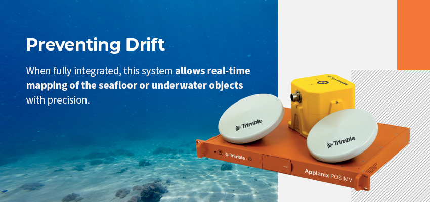
Preventing Drift
Even the world’s best IMUs slowly accumulate errors, a phenomenon known as drift. The GNSS receiver is critical here, anchoring the position estimate several times a second and correcting any drift before it becomes significant. The resulting hybrid solution delivers a continuous, meticulous feed of both position and orientation, which is critical for precise sonar mapping and precision navigation.
When fully integrated, this system allows real-time mapping of the seafloor or underwater objects with precision that meets and often exceeds stringent standards set by the International Hydrographic Organization (IHO), regardless of weather or water conditions.
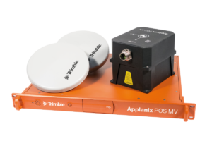
The Applanix POS MV
When projects demand the very best, experienced marine professionals specify the Applanix Position and Orientation System for Marine Vessels (POS MV). Trusted worldwide, the Applanix POS MV system has set the industry standard for robust, high-precision motion compensation and navigation afloat. Unique among navigation solutions, POS MV is engineered with features designed expressly for challenging marine environments.
Unlike magnetic compasses, which are vulnerable to interference from steel hulls or nearby equipment, the POS MV’s GNSS Azimuth Measurement System (GAMS) uses dual antennas spaced precisely apart to calculate a reliable, drift-free heading. This innovation ensures superior reliability, even in the presence of electromagnetic interference, a common problem in ports and around construction barges.
Applanix also leverages TrueHeave™ technology to compensate for vessel heave. This technology goes beyond old-fashioned filtering to deliver heave corrections in real time, with no need for trial-and-error filter tuning. The result allows operators to save countless hours on post-processing, delivering clean, artifact-free bathymetry and backscatter data.
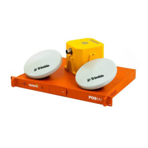
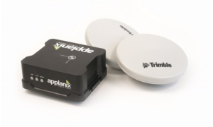
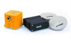
Comparing Applanix POS MV Models
Applanix offers several specialized POS MV configurations, and each one is engineered for specific vessel types and operational requirements. Here’s how to select the ideal system:
- SurfMaster: This system delivers economical performance for shallow-water multibeam sonar and portable deployments. It is best for compact survey launches and near-shore survey work.
- WaveMaster ll: WaveMaster provides robust reliability in coastal and harbor sea states, making it suitable for the majority of professional marine construction projects. This system is best for standard hydrographic survey vessels and construction barges.
- OceanMaster: The final system delivers unmatched stability and precision for missions demanding “Order 1a” or “Special Order” IHO classification. OceanMaster handles extreme sea states, long mission durations, and demanding offshore dynamics, making it best for ocean-class research and deep-water missions.
If you have questions about which option suits your application, the Measutronics team can help specify and integrate navigation solutions.
Why Expertise Matters for Installation and Integration
Even the most advanced INS is dependent on flawless installation and calibration. Two factors demand specialist attention, including the lever arm challenges and patch test calibration.
Positioning accuracy hinges on a geometric principle — the lever arm, which is the exact measured distance between the Inertial Motion Unit, GNSS antennas, and the sonar head. Even a small mistake here can introduce critical errors. Measutronics field teams use precision survey techniques, taking measurements down to the millimeter to guarantee the system’s reference geometry matches the real world.
For the INS, sonar, and GNSS sensors to work as a perfectly synchronized suite, rigorous calibration is essential. Measutronics performs detailed patch tests and specialized calibrations that align all spatial offsets and orientations, giving operators total confidence in their data.
Unlike vendors who simply ship hardware, Measutronics delivers complete installation, measure-ups, and commissioning support to ensure every system performs to specification in real-world and on-the-water conditions.
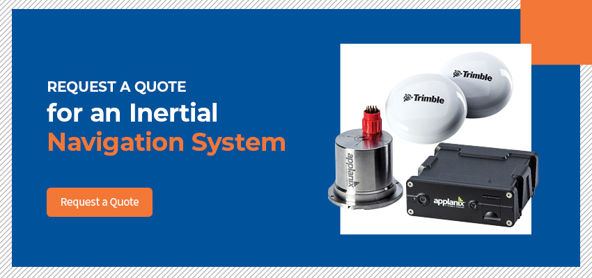
Request a Quote for an Inertial Navigation System
Stop fighting unreliable data, wasted hours, and survey delays. With a properly integrated GNSS INS, your crew can operate confidently in the world’s toughest marine environments.
Whether you’re looking for an Inertial Navigation System for sale, wanting to upgrade a legacy system, or troubleshooting integration problems in the field, Measutronics is here to help. Our expert team will consult with you to deliver a system solution tailored to your vessel, equipment, and project requirements.
Ready to stop discarding data and start maximizing your survey capabilities? Contact Measutronics to request a customized quote for an inertial navigation solution engineered for your challenges.
- Applanix POS MV SurfMaster One (Spec Sheet)
- Applanix POS MV Surfmaster (Spec Sheet)
- Applanix POS MV WaveMaster II (Spec Sheet)
- Applanix POS MV OceanMaster (Spec Sheet)
- Applanix POS MV Elite (Spec Sheet)