New Release: POSPac Go! from Applanix

Applanix has recently introduced POSPac Go! – a new feature to their industry leading GNSS-aided inertial post-processing software POSPac. It is an automated method of processing RTK corrections used during data acquisition to develop a smoothed best estimate of trajectory (SBET) file for use in a wide array of hydrographic survey packages. As with the standard POSPac processing, the option to use Trimble’s CenterPoint RTX satellite-based corrections is available as well. This functionality is available to current POSPac users running the latest POSPac firmware, as well as POS MV v10.3 or newer.

Looking for more information about POSPac Go!? Please call us at (863) 644-8712.

Trimble Honors Measutronics’ Nathan Keys with Outstanding Service Award

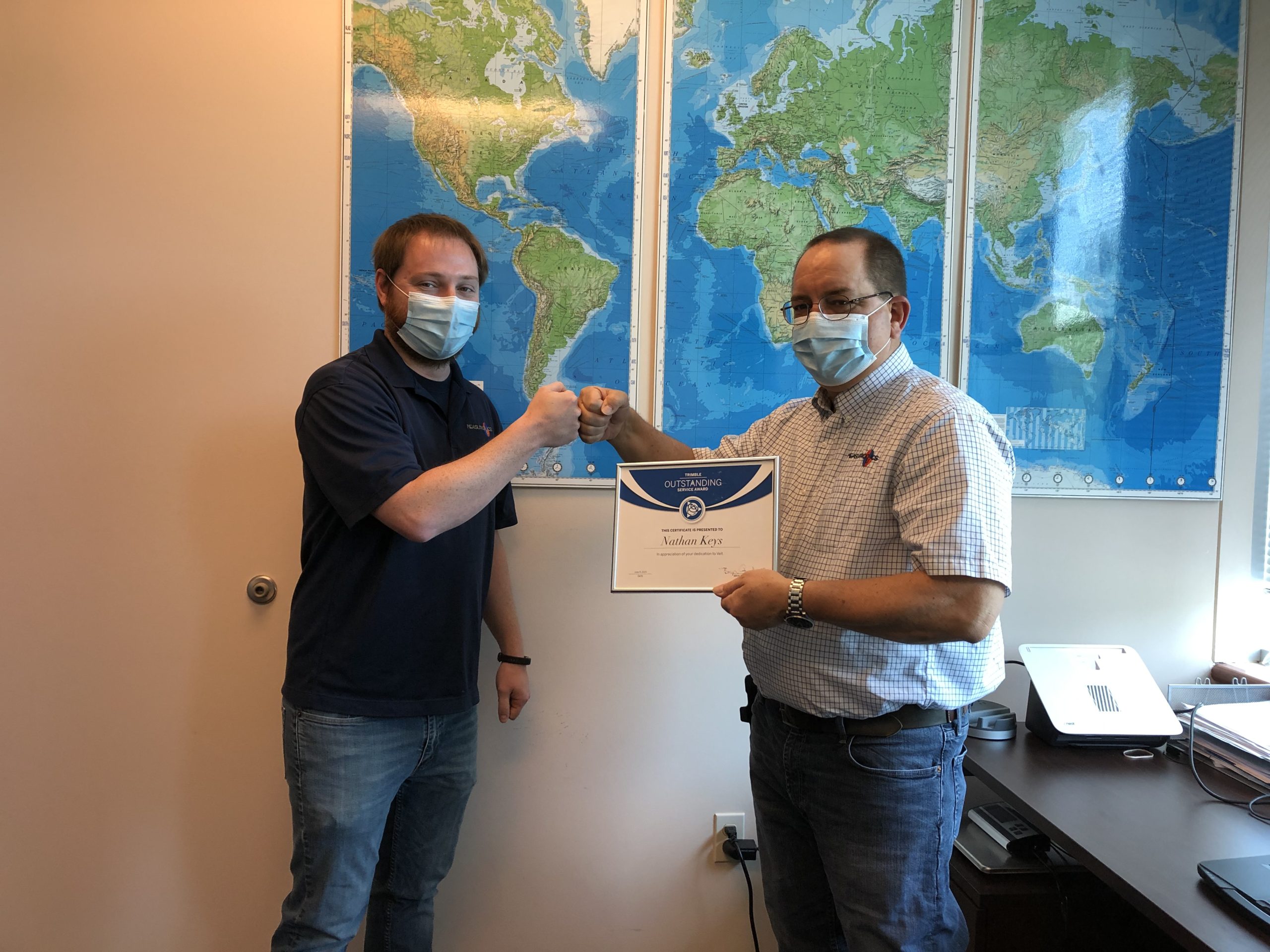
Trimble has given an Outstanding Service Award to Measutronics’ Nathan Keys earlier this week. Nathan received a support call from Veit & Company, Inc. late in the evening at the end of the week, reporting a production interruption on a 24 hr/day project. Nathan made the considerable effort to coordinate between Trimble departments across the world to get the customer back up and running with minimal downtime.

As a result, Veit reached out to Trimble to recognize his effort as critical to the work they accomplished through the weekend. Measutronics, as a Trimble Advanced Marine Partner, prides itself in its ability to provide quality technical support in their customers’ times of need. Nathan leads the Measutronics team in their Vancouver, WA office and has been with the company for 7 years.

Trimble RTX is now available for the Marine market!

Trimble’s satellite-based correction service, Trimble RTX, have seen a few updates recently, but the most recent is a game changer for Measutronics. Trimble RTX is now available for marine markets, including ALL inland rivers and lakes, harbors and ports, and Great Lakes – up to 5km offshore.

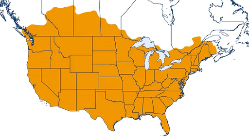
This comes just a month after Trimble announced that their flagship RTX service, CenterPoint RTX Fast Correction service, has reached full coast-to-coast coverage of the continental United States. This capability has become more prevalent over the years, especially in the last few years now that the US Coast Guard is nearly done decommissioning their nationwide Differential GPS service.

For more information about Trimble RTX and how to subscribe, contact us.

Measutronics is Working to “Get Kids into Survey”

Measutronics has joined the international Get Kids into Survey (GKiS) community in an effort to fuel the interest of future generations in everything geospatial. GKiS began in 2017 with a single poster that would help children understand what their parents do at work. It has since grown to include several posters depicting different surveying scenarios, a comic book, online resources for young surveyors and educators, a “SurveyFest” community event, and even an education fund to support GKiS ambassadors, school visits and more.

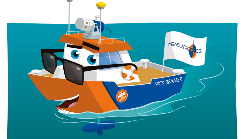
As Measutronics is a fixture in the hydrographic equipment and marine solutions industry, naturally their flagship demonstration vessel is the latest hero to join the GKiS squad. Dubbed “Nick Beamer,” our hero specializes in full vision everywhere around him. Equipped with marine LIDAR and multibeam SONAR on a pan & tilt mechanism, Nick Beamer collects a dense 3D point cloud above and below the water. No villain can hide from his scans!


Old Friends and New Technology: CONEXPO-CON/AGG 2020 Wrap up

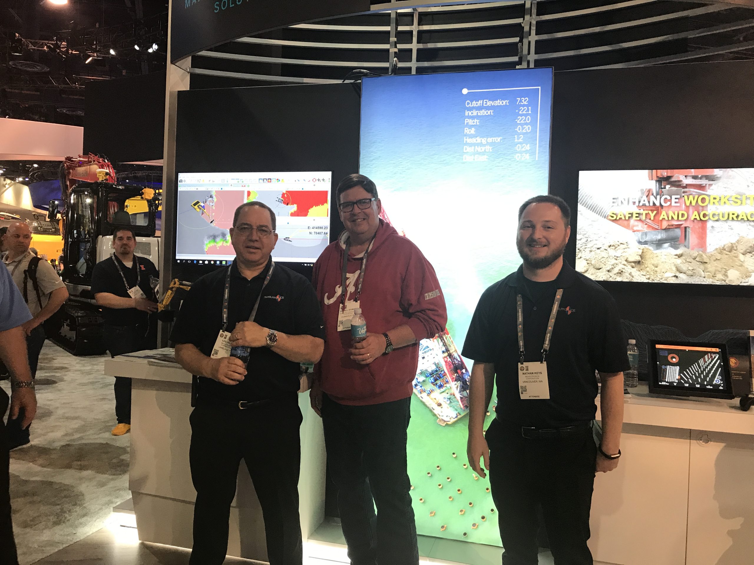
Measutronics joined Trimble at CONEXPO-CON/AGG 2020, North America’s largest construction trade show, in Las Vegas, NV in March. Measutronics, a Trimble Advanced Marine Partner (AMP), demonstrated Trimble’s latest marine construction guidance systems using Trimble Marine Construction (TMC) software. TMC was displayed on a monitor and mirrored a typical setup an excavator operator might use in dredging and material placement operation. The software demonstration included a model excavator, equipped with sensors that mimic machine control, to give a realistic simulation of real-time excavator guidance in TMC.

During the conference, Darrell Stewart, Director of Operations at Southwind Construction, came to get a first-hand look at TMC software in action. Darrell (middle) met with Measutronics President, Lou Nash (left) and Construction Systems Specialist, Nathan Keys (right) at the booth. It was a reunion for Darrell and Lou as Measutronics’ first dredge guidance system was installed on a cutter suction dredge in the Southwind Construction fleet. Installed in 2003, utilizing Trimble’s HYDROpro software, the system is still in operation today.

Trimble now offers a complete system to provide all the hardware and software necessary for dredge guidance. If you would like more information on these systems and other offerings from Measutronics, please send us an email at sales@measutronics.com.

Measutronics Introduces GPS and SONAR to Elementary Students

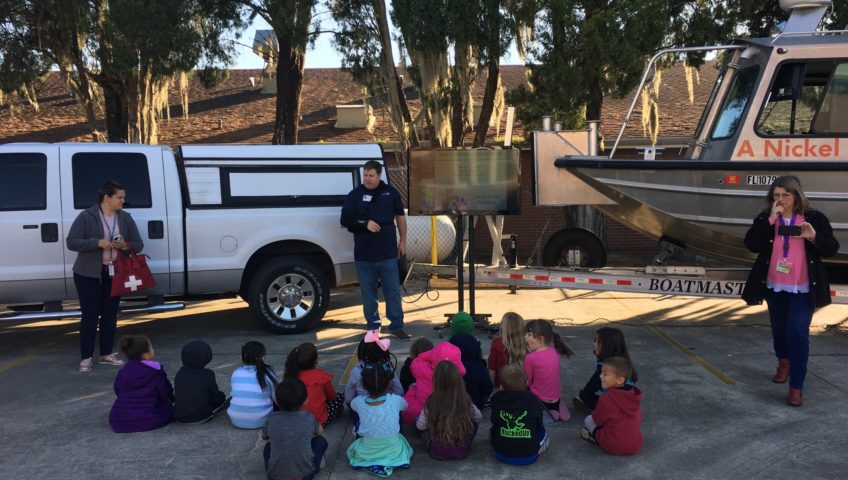
Measutronics visited Purcell Elementary School in Mulberry, Florida as part of the annual Great American Teach-In. The Great American Teach-In is an annual event coordinated by the Polk County Public Schools’ to celebrate American Education Week. During this event, members of the community are invited to speak to students about their careers, travel and hobbies, and how their early educational experiences relate to their current lives.

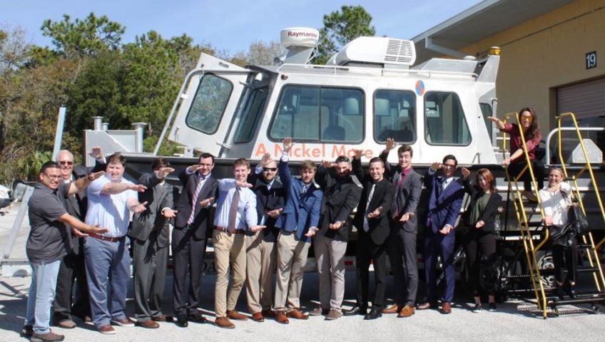
Measutronics brought a TV to give the students an overview of how GPS works and how they use it in their projects. They also brought their survey vessel “A Nickel More” for the students to board and see first-hand cutting edge hydrographic equipment. This is the 3rd year Measutronics has participated in this event.

Measutronics Hosts Oregon State University

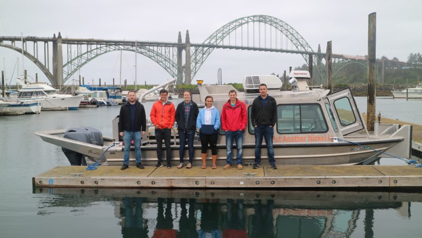
The CE 560 Hydrographic Surveying class from Oregon State University were hosted by Measutronics for on-water demonstrations of a fully equipped survey vessel earlier this summer. The class consisted of both undergraduate and graduate students that got to see high resolution multibeam data acquisition in real-time. Many topics that are covered in the course were on display, including: transducer transmit and receive arrays, GNSS antenna and IMU installation, lever arms, and patch tests. This type of on-hands demonstration enables students to gain a deeper understanding of the system as abstract ideas are put in to practice.

Measutronics has a strong commitment to furthering education in hydrographic surveying and other marine systems applications, and is a long standing supporter of The Hydrographic Society of America (THSOA). With their newest office being located in the Pacific Northwest, Measutronics hopes to continue to host more groups like this in the future.

University of Florida comes to Lakeland

The senior class of the University of Florida’s Geomatics program visited Measutronics in the course of a day-long field trip. The purpose of the visit was to expose the soon-to-be-looking-for-employment students the different industries and professions available within this field. Students got a first-hand look at cutting edge technology and the teamwork that is required for Measutronics’ integrated solutions.

GPS Week Number Rollover (WNRO) Information

Summary: GNSS receivers that rely on Global Positioning System (GPS) face a notable event on April 6, 2019, because it marks a reset of their date information known as the GPS Week Number Rollover (GPS WNRO). Receivers that are not current with their firmware risk incorrectly reporting the GPS week which may cause additional unforeseen consequences.

Background: GPS dates are expressed as a week number and a day-of-week number, with the week number transmitted as a ten-bit value. This means that every 1024 weeks (about 19.6 years) after Sunday 6 January 1980 (the GPS epoch), the date resets again to that date; this happened for the first time at 23:59:47 on Saturday 21 August 1999 and will happen again at 23:59:42 on 6 April 2019 and on 20 November 2038.

Solution: To address this concern, modernized GPS navigation messages use a 13-bit field, which only repeats every 8,192 weeks (157 years), and will not return to zero until near the year 2137. Legacy systems with current firmware will also be unaffected. To verify you’re using the current firmware, refer to Trimble Installation Manager. All Trimble receivers with firmware version ≥2.32 will continue to operate normally following the rollover.* It is always recommended to have quality checks in place before or during the collection of data, such as checking into known control points, to ensure equipment is working properly.

*NOTE: New Trimble GNSS receivers MPS865 and SPS785 MUST use the most recent FW despite being greater than v2.32.